Gday.
I’m wondering if the old alluvial field on the top of Panama creek/Mount Wilson at Golconda is accessible?
Is there an access track on public land or do I need to get private landholders permission to drive up to the old workings?
3 Likes
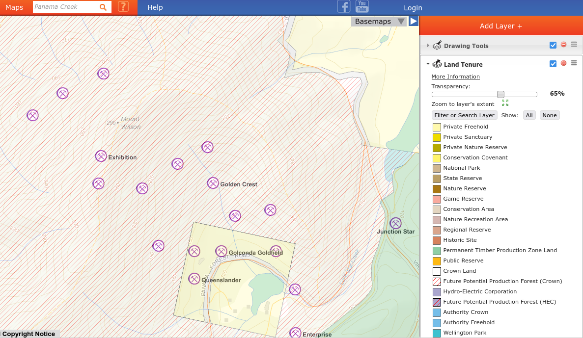
I find the best way is to use LISTmap.
Something it has that MRTMap doesn’t is Land Tenure.
The way to get to it on the RHS > Add Layer+ > Click it and then go to ‘Manage Layers’ and the top entry is ‘Land Parcel & Property’ then ‘Cadastre’ then at the bottom of the list ‘Land Tenure’. Click the ‘+’ sign to add it as a layer.
Now you have all the different land ownerships for an area. Use the 'transparency slider to show your original layer.
At first this seems complex but it’s not too bad.
This shows the details you need to go into an area legally. It looks like most of this area is state forest except the private land around the sharp bend near the dam. This is a private holiday resort.
I also have Primary Industries > Mining > ‘Mineral Occurences’ as another layer in the screengrab.
Occasionally Listmap may not be up to date but mostly it’s good to use.
4 Likes
Forgot to mention this doesn’t tell you if there is a current mining lease. I use the Trilobite phone app or MRTMap for that info.
1 Like
Thanks Karl.
I had been using the MRT’s link to LIST map which didn’t have the land tenure maps.
That was exactly what I needed.
2 Likes